TREE CANOPY COVER - 22%
What is a Urban Tree Canopy (UTC) Assessment? An urban tree canopy (UTC) assessment is an analysis of the amount of tree canopy that covers an area, as seen from aerial photos during summer months (when leaves are on the trees). UTC is expressed in a percent coverage of total land. The tree canopy, representing the percentage of land covered by trees, is an important metric for gauging changes in the region’s urban forest.
|
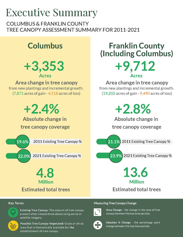
New Report Now Available! The City of Columbus and Franklin County have jointly unveiled the 2011-2021 Tree Canopy Assessment, marking the first comprehensive examination of central Ohio’s trees and the evolving tree canopy over the past decade. The Tree Canopy Assessment examines the change in tree canopy from 2011 to 2021, which was the most recent data available at the time of the study. Read more about the most recent findings here.
|
|
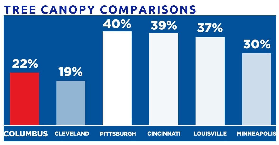
HOW DO WE COMPARE?
Compared to cities of similar size, Columbus' tree canopy lags behind.